Powder Predictor
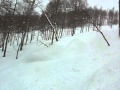
Winter returns to Vail Valley as cold Arctic air welcomes February
Aspen/Snowmass could be in the mix again
Another curve ball from the weather gods as models showed strong high pressure just last week, and now winter returns. Frigid temps to be expected Tuesday, Feb. 1, as a surface low will impact the Western Slope early Monday and remain through the day, giving Colorado a quick shot at snow.
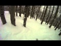
The real story is the associated cold front dropping just behind as Arctic air will dominate mid week with heavy bands of snow expected Monday night into Tuesday.
Expect on-mountain highs for Monday in the 20s, with brisk west to southwest winds, with around 2-4 inches on the ground. The real fun starts Monday night as a cold front will overtake the low and spark at times heavy snow showers overnight Monday.
Tuesday we still see unsettled weather, with on-mountain highs barley hitting zero degrees Fahrenheit. Winds will be light but noticeable as windchill values will drop well below freezing for Tuesday and Wednesday. Expect 3-6 inches for the Tuesday morning report for Vail/Beaver Creek, with Aspen/Snowmass in the 4-7 range.
Overnight lows will be in the negative teens for Tuesday and Wednesday, with light winds and some lingering snow showers Tuesday night.
These frigid temps will remind us of what we saw just two weeks ago, so expect any snow on the ground to be "squeaky" and hard to get through. The warm-up begins Thursday, with another round of snow expected by the weekend. A welcome change to what many forecasters thought would be a quiet and dry two weeks.
Overall, a great start to February, as this first storm could drop nearly a foot in some of the central mountain areas, including Aspen/Snowmass and Crested Butte. We shall wait and see; for now, get the boot heaters cranked and make sure the gas tank in the car is full.
Enjoy!
![]() 0 Comments on "Winter returns to Vail Valley as cold Arctic air welcomes February"
0 Comments on "Winter returns to Vail Valley as cold Arctic air welcomes February"
Be the first to comment below.
 Vail Town Council to weigh new plan to redevelop T...
  All about indexes
  Transforming your social security into a winning r...
  Pass sales, real estate transactions, revenues inc...
  Vail Valley native with passion for Biophilic inte...
  Land Trust, ECO Trails, Vail Resorts team up to cl...
  EUROVISION named Host Broadcaster for 2015 World A...
  Vail Resorts brings back Lindsey Vonn's 'School of...
  Hundreds turn out for 2015 World Championships vol...
  Eagle County Senior Health Expo and 9th Annual Hea...
  Final race of Vail Mountain Trail Running Series s...
  Before you write your will ...
  2015 World Ski Championships volunteer recruitment...
  Ascent Sotheby’s International Realty in Vail an...
  CDOT outlines road closures for local stages of US...
  Italian artist creates unique trophies for Vail, B...
  Vail Recreation District once again hosting Jake W...